About WMS maps
WMS maps are georeferenced map images available over the Internet. WMS maps can be (optionally) used as a background in a cruise track window. A WMS map may be useful in that it can provide a geographic context for echogram data. Georeferenced data (like coastlines, rivers, population features, roads or ocean features) may be grouped in "layers" and can be requested or not requested from the WMS server.
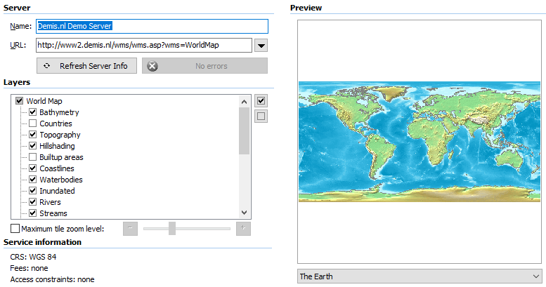
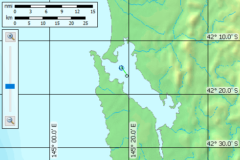
Screenshot (top) Echoview's interface for a WMS map URL, available layers and preview. Screenshot (bottom) AutoOpen.EV cruise track in Macquarie harbor Tasmania.
 |
 |
Echoview provides a (small) list of WMS servers on the WMS Map Properties dialog box. WMS servers can be slow or they can change or disappear. A WMS map service may be free of cost or entail a fee or require registration.
Listings of WMS servers include:
Echoview support for WMS maps:
Notes:
- A WMS map with an unusual map projection may not be rendered correctly by Echoview. For example, Echoview incorrectly renders Geoscience Australia WMS map GDA94 / Geoscience Australia Lambert (this is a conical projection).
- Use the Echoview Configuration setting Disable Echoview downloads to prevent Echoview from downloading data when the internet is unavailable.