About off-axis angle line offsets
This line-generating feature is designed to help you to produce a seabed roughness indicator for use in seabed classification analysis (see ref. Kloser R.J. et al., 2001. Remote sensing of seabed types in the Australian South East Fishery; Development and application of normal incident acoustic techniques and associated ‘ground truthing’. J. Mar. Freshwater Res., 52,475-89).
It provides the facility to generate a new line offset below a source line (normally a bottom pick line). The new line is determined as a function of a constant angle off the acoustic axis. Two lines are generated from two angles (the ‘opening’ and ‘closing’ angles) which define a “constant angular sector”, that is a layer beneath the bottom pick which is integrated for each interval to provide a roughness indicator. This method assumes normal incidence and a flat (non-sloping) bottom. For further details and references see Kloser et al. (2001).
A new line is defined relative to another based upon an off-axis angle calculation as follows:
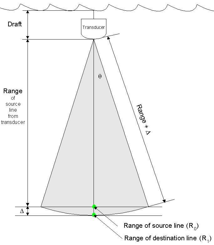
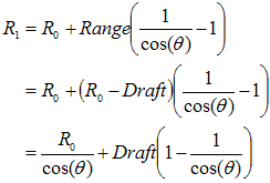
R1 = R0 + D
Where
R0 is the range of a point in the source line
R1 is the range of a point in the destination line (below, that is, deeper than, R0)
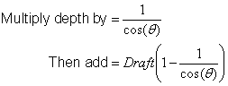
D is an offset calculated using the transducer draft, range and off-axis angle (q) as illustrated below:
Where:
Draft is the depth of the transducer below the water surface
Range is the range of the source point from the transducer = R0 - Draft
Then:
![]()
![]()
Note: This calculation assumes a vertically oriented transducer, in which the range and depth dimensions are coincident. Echoview considers the draft of the selected transducer only, it does not consider transducer orientation.
This is identical to applying an offset by linear function with: