About solar elevation
Solar elevation is the angle of the sun above or below the horizon at a given time and location. It provides a convenient measure of the sun’s position relative to the Earth’s surface. In Echoview, the Solar elevation at pings operator calculates solar elevation for each ping using platform position and time information.
Interpretation
Solar elevation provides information about time of day that can assist in interpreting acoustic data. For example:
- Positive values indicate that the sun is above the horizon
- A value of 0° indicates that the center of the sun is at the horizon
- Negative values indicate that the sun is below the horizon
Changes in solar elevation are often associated with changes in biological behavior and may assist in the interpretation of temporal patterns in acoustic data, such as those related to diel vertical migration.
Solar elevation can also be used to distinguish commonly defined daylight, twilight, and night periods:
- Daylight: solar elevation > 0°
- Civil twilight: 0° to −6°
- Nautical twilight: −6° to −12°
- Astronomical twilight: −12° to −18°
- Night: solar elevation < −18°
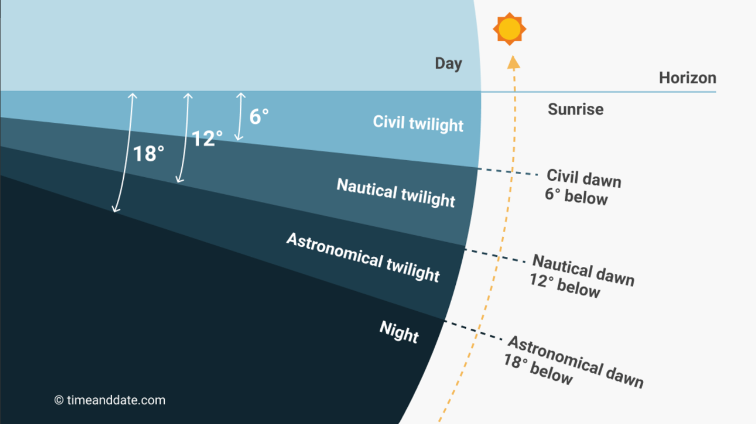
Figure: Relationship between the solar elevation angle and daylight, twilight phases, and night. Image © timeanddate.com, used for illustrative purposes.
In marine environments, changes in solar elevation can influence light availability and diel patterns in biological activity. Solar elevation may therefore provide useful context when interpreting temporal patterns in acoustic data.
For further background on how light propagates in the ocean, see the NOAA: How far does light travel in the ocean?.
Calculation notes
Solar elevation is calculated from the position of the sun relative to the platform position on the Earth’s surface. The calculation is performed in UTC; the specified time zone offset is used to convert the operand’s local ping times to UTC.
The calculation uses low-accuracy solar position equations published by the National Oceanic and Atmospheric Administration (NOAA). These equations provide an approximate solar position and are computationally efficient for evaluation at each ping.
Echoview accounts for leap years when calculating the fractional year.
Calculated values are subject to several limitations:
- Results are approximate and may differ by a fraction of a degree from higher-accuracy solar position calculations.
- The calculation does not account for local horizon features or variable atmospheric conditions.
- An incorrect time zone offset, including an unaccounted-for daylight saving time adjustment, will shift the calculated solar elevation relative to local time.
For additional background on solar position calculations, see the NOAA Solar Position Calculations: https://gml.noaa.gov/grad/solcalc/solareqns.PDF
See also
Solar elevation at pings operator
Solar Elevation At Pings page
About solar elevation data
About time series data
Solar elevation CSV format
About virtual variables