About solar elevation data
Solar elevation data are time series measurements representing the angle of the sun above or below the horizon, calculated per ping in Echoview using the Solar elevation at pings operator. They are provided as a virtual time series data type.
Solar elevation variables
The Solar elevation at pings operator creates a virtual time series representing the sun’s elevation angle for each ping. The calculation uses:
- Ping timestamp
- Platform position (latitude and longitude)
- A user-specified time zone offset
The resulting values are expressed as angles in degrees, where positive values indicate the sun is above the horizon and negative values indicate the sun is below the horizon.
Display and use
The solar elevation time series data can be displayed on graphs, used in conjunction with echograms, or visualized spatially. For example, it may be:
- Displayed as a time series graph alongside acoustic data.
- Displayed as a table.
- Displayed using an alongtrack display to show variation in solar elevation along the survey track.
- Used with Time series range bitmap to include or exclude data based on time of day.
- Used with other operators, such as Code - Time series, to filter or extract data for specific periods, such as daytime or twilight conditions.
- Used as an overlay (e.g., from the Time Series Overlay page) or reference when interpreting echograms.
- Used to categorize data into day, twilight, and night periods for further analysis.
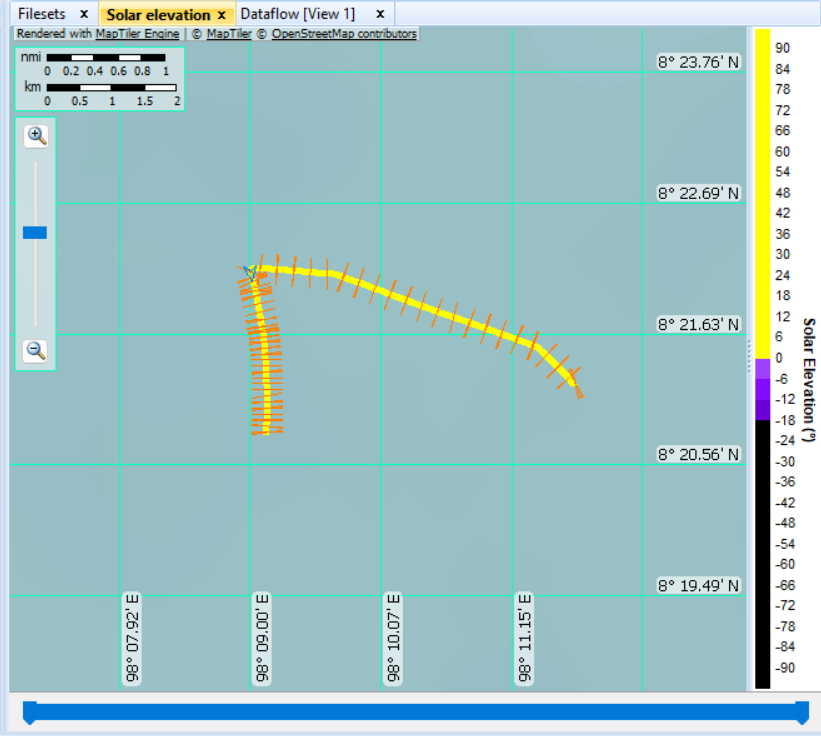
Figure: Cruise track displayed using the Solar elevation color scheme. Yellow indicates daylight conditions, while purple and black colors indicate twilight and nighttime conditions. For further information, refer to About solar elevation.
Data requirements and limitations
The calculation of solar elevation requires valid position and time information for each ping.
- If input data (e.g., GPS position) are invalid or unavailable, solar elevation values may be reported as no data and may not be displayed
- The accuracy of the calculation depends on the accuracy of the input position, time, and time zone offset, and on the assumptions of the underlying solar position model
- The time zone offset is user-specified. Incorrect settings (including daylight saving time adjustments) may shift solar elevation values relative to local time
For fixed platforms, position information can be specified in the platform properties.
For fixed platforms, position information can be specified in the platform properties.
See also
Solar elevation at pings operator
Solar Elevation At Pings page of Time Series Properties dialog box
Solar elevation CSV format
About time series data
Time series graph