About 3D projections
Echoview needs sometimes to represent the three-dimensional world on your two-dimensional screen. This requires the use of geographic data and a system of mapping or projecting that data onto two-dimensional surfaces. This occurs in two distinct steps:
-
project the (spherical) geographic coordinates (latitude, longitude and depth) to an orthogonal coordinate system (X, Y, Z).
This uses the map projection selected on the Mapping page of the EV File Properties dialog box. -
project the view of this orthogonal coordinate system (X, Y, Z) onto your screen (X, Y) - or any other 2D format (e.g. image files)
For scenes, this uses the 3D projection selected on the General page of the Scene Properties dialog box.
For image files the orthographic projection is always used.
This page covers 3D projections (see About mapping and map projections for a discussion of map projections).
Two 3D projections are available:
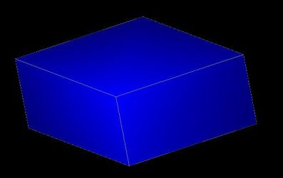
Perspective
The perspective projection is used to produce images which look natural. When we view scenes in everyday life far away items appear small relative to nearer items. This is called perspective foreshortening. A side effect of perspective foreshortening is that parallel lines appear to converge on a vanishing point. An important feature of perspective projections is that straight lines look straight.
The perspective projection is the default and recommended for viewing most scenes.
|
Why use perspective projection? |
||
|
|
|
|
|
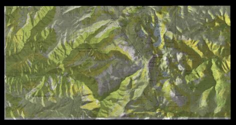
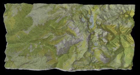
Orthographic |
Perspective |
|
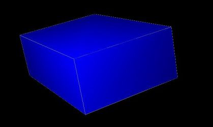
Orthographic
The Orthographic projection is typically used by drafters and engineers to create working drawings of an object which preserves scale and shape. An important feature is that parallel lines in space appear parallel on the projected image. This differs from the perspective projections in which parallel lines can converge to a single vanishing point in the distance.
The orthographic projection is recommended if you intend to look at map views (on the Scene window, right click, then click Map View). This will ensure than a vertical pole in the scene looks like a point on the screen.
|
Why use orthographic projection? |
||
|
|
|
|
|
Orthographic |
Perspective |
|