Exporting georeferenced samples
You can export Georeferenced Samples (as 3D points) from selected acoustic variables of supported data types to a .points.csv file.
To export all Georeferenced Sample data from a variable:
- Display an acoustic variable.
- On the Echogram menu, point to Export, Georeferenced Samples and click Whole Echogram...
- When it is a multibeam variable, specify the pings to export.
- Enter the filename for your export in the Export data as Georeferenced Samples dialog box.
Output is *.points.csv or *.mb.points.csv (multibeam data).
To export Georeferenced Sample data from a selection or region:
Display an acoustic variable.
- Use one of the selection tools to make a selection for export or select a region.
- On the Shortcut menu, point to Export Selection or Export Region, and click Georeferenced Samples...
- When it is a multibeam variable, specify the pings to export.
- Enter the filename for your export in the Export data as Georeferenced Samples dialog box.
Output is *.points.csv or *.mb.points.csv (multibeam data).
To export Georeferenced Samples by Regions
- Display an acoustic variable.
- On the Echogram menu, point to Export, Georeferenced Samples and click By Regions...
- Specify the region class or classes on the Export values as Georeferenced Samples by Regions - Select Classes dialog box and click Export.
- Enter the filename for your export.
Output is *.points.csv or *.mb.points.csv (multibeam data).
A selection and Georeferenced Samples by Regions
Georeferenced Samples are exported for regions that overlap a selection time. For this type of export, the region(s) might not overlap the selection.
- Display an acoustic variable.
- Use one of the selection tools to make a selection on the echogram.
- On the Shortcut menu, point to Export Selection, Georeferenced Samples by Regions...
- Specify the region class or classes on the Export Selected Values as Georeferenced Samples by Regions - Select Classes dialog box and click Export.
- Enter the filename for your export.
- Click Save.
Output is *.points.csv
Notes:
- See also Cancel export.
- For the georeferenced sample export for complex data output by ping, no data samples are not included in the export.
- For the georeferenced sample export for complex data output by region, no data samples are included in the export.
- Empty export files are often caused by missing or unsuitable GPS data.
Each line in the file is described by the .points.csv format.
|
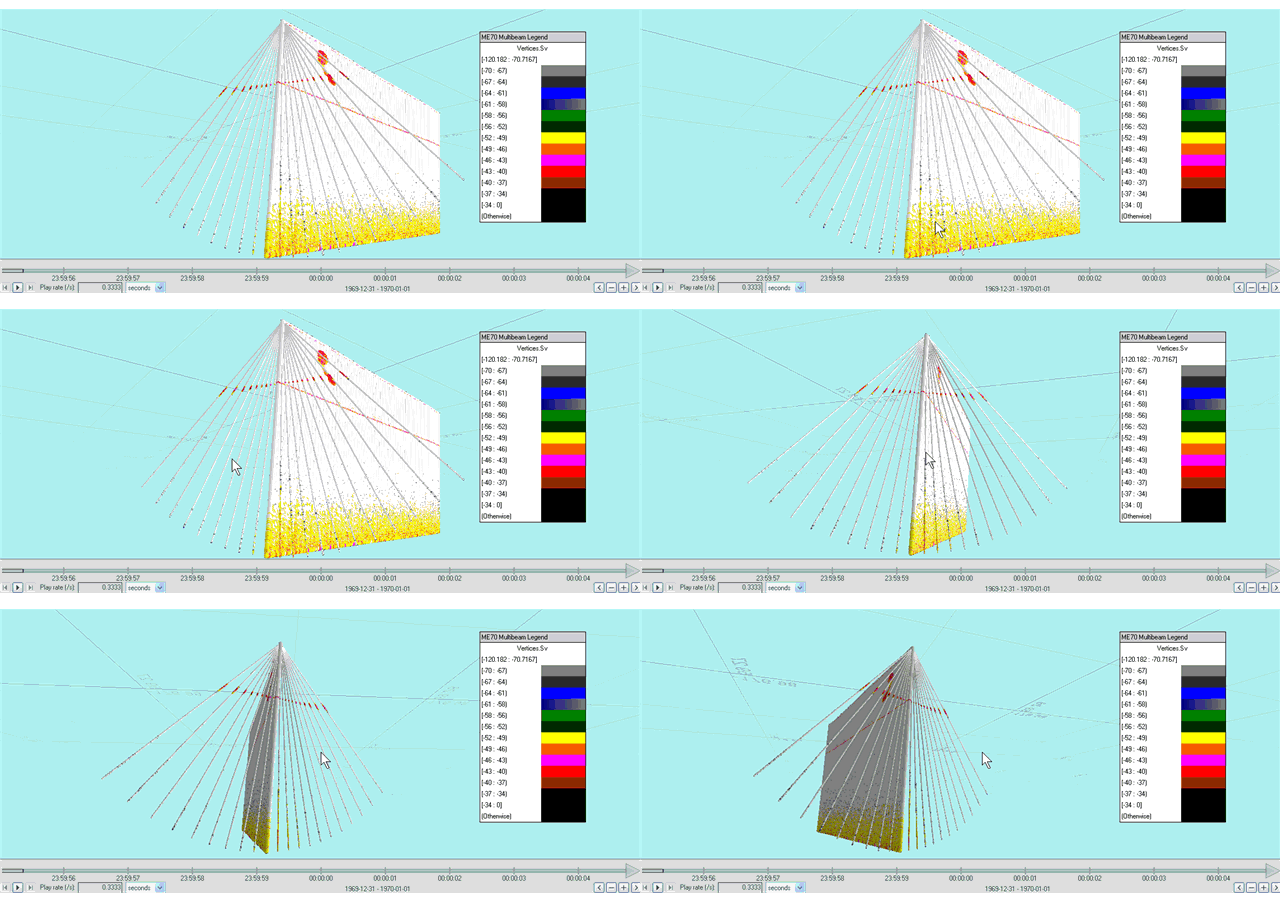
Exported Georeferenced Samples from a ME70 Multibeam echogram and a ME70 Single beam echogram from the middle beam in the fan displayed in Eonfusion. |
|
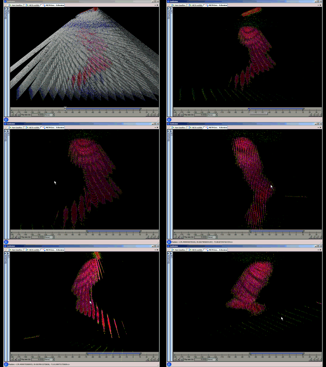
Exported Georeferenced Samples from multibeam pings in a ME70 echogram - Sv linked to scene slider and school revealed in Eonfusion. |
Georeferenced samples as 3D points export files (*.points.csv)
The .points.csv format is used by:
- the Echogram menu, Export, Georeferenced Sample, Whole Echogram... feature
- the Echogram menu, Export, Georeferenced Samples, By Regions... feature
- the Shortcut menu, Export Region, Georeferenced Samples... feature
- the Shortcut menu, Export Selection, Georeferenced Samples... feature
A *.points.csv file may include some or all of the following variables:
|
Variable |
Description |
||||||||||||||
|
Ping_index |
Ping number Note: In Echoview, pings are renumbered sequentially beginning with 0. |
||||||||||||||
|
Beam_index |
The beam index number. Note: Only exported for multibeam data. |
||||||||||||||
|
Latitude |
The latitude (degrees) of the GPS antenna at the time the ping was transmitted. |
||||||||||||||
|
Longitude |
The longitude (degrees) of the GPS antenna at the time the ping was transmitted. |
||||||||||||||
|
Altitude |
Altitude of the sample in meters. |
||||||||||||||
|
Depth |
Depth of the sample in meters. Depth is relative to the Z coordinate of the water level (relative to the platform system reference point) on the Position page of the Platform Properties dialog box. |
||||||||||||||
|
Sample value |
Sample value for the acoustic variable. Includes complex and pulse compressed complex data types.
|
||||||||||||||
|
Region ID |
The ID number of the region. This variable is output when the Echogram menu, Export, Georeferenced Samples, By Regions ... feature is used. |
Notes:
- Echoview does not include projection metadata (associated with the data) with the export. Any projection metadata should be recorded separately.
- Analysis page Exclusions are applied to exported georeferenced data.

